Recreation Facilities
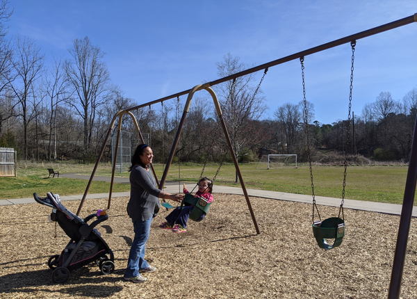
From neighborhood parks to greenways, Hillsborough offers many opportunities for recreation. Town parks are managed by the Public Space and Sustainability Division, which implements decisions made by the Parks and Recreation Board. The Town of Hillsborough does not provide recreational programming. Orange County provides recreational programming and additional parks in and around town. The Hillsborough Visitors Center offers suggestions and maps that can help with planning down time in Hillsborough.
Town-maintained parks and greenways are open daily from 8 a.m. until a half hour after sunset.
To reserve a park facility, visit the reservations section of this website.
For additional information about recreation in Hillsborough, see frequently asked questions.
Park and recreation facility locations in town can be found on the Town Map on this website. An Orange County interactive trails and greenways map and a county interactive parks locator map can be found on the county website.
Riverwalk
Riverwalk is a paved, accessible, urban greenway that stretches about 2 miles along the Eno River between Gold Park in western Hillsborough and trails east of town. For more information, visit the Riverwalk page on this website.
Calvin Street Greenway
The Calvin Street Greenway provides a connection from Calvin Street south to Riverwalk and Gold Park. It is a 300-foot paved, accessible path with a 100-foot elevated walkway. It allows pedestrian and bicycle access from downtown and adjacent neighborhoods.
Ridgewalk greenway
The proposed greenway would run north-south connecting downtown to the future train station site and Cates Creek Park.
Cates Creek Park
Located at 1445 Cates Creek Parkway, Cates Creek Park is a nearly 17-acre park. Amenities include restroom facilities, playground, multi-use field with soccer goals, and picnic tables. A skate spot will be built in 2024. See the park's master plan on the Parks and Recreation Board page for more information.
Gold Park
Located at 415 Dimmocks Mill Road, Gold Park is a 20-acre park. The park includes 0.3 miles of the Riverwalk greenway and links to downtown through Riverwalk. Amenities include restroom facilities, playground, dog park, multi-use field, picnic tables, picnic shelters, natural areas, pedestrian trails and a pollinator garden and bee hotel. A trail map is available below. See the park's master plan on the Parks and Recreation Board page for more information.
Hillsborough Heights Park
Located at 510 Terrell Road, Hillsborough Heights Park includes a tot lot. Amenities include playground equipment, picnic tables and a grill. See the park's master plan on the Parks and Recreation Board page for more information.
Kings Highway Park
Located at 1001 Ben Johnston Road, Kings Highway Park is an 18-acre natural area. The property is bounded on the south and west by Lake Ben Johnston. The park was developed by volunteers. It has almost 1 mile of nature trails. The name Kings Highway Park is based on the research of Tom Magnuson, who documented the presence of remnants of a river ford and historic road known as King’s Highway on the property. Amenities include trails, a kayak launch and a picnic area. See the park's master plan on the Parks and Recreation Board page for more information.
Mayo Park
Located on the south side of West King Street, adjacent to the town parking lot, Mayo Park is a pocket park named in memory of Odell Mayo, a former town employee. Mayo retired from the Public Works Division and was responsible for keeping downtown swept and clean. Amenities include a sitting area.
Murray Street Park
Located at 225 Murray St., Murray Street Park is slightly under 1 acre. Amenities include playground equipment and a picnic area. See the park's master plan on the Parks and Recreation Board page for more information.
Turnip Patch Park
Located at 333 W. King St., Turnip Patch Park is a 0.6-acre neighborhood park built primarily with volunteer donations. A neighbor, Hoyt Crabtree, previously had permission from the town to plant a garden on the site, and the water account for the site bore the name "Turnip Patch." When neighborhood residents petitioned the town for permission to build a park, they asked to keep the name. Amenities include playground equipment and a games area. See the park's master plan on the Parks and Recreation Board page for more information.
Exchange Park
Located at 331 Exchange Club Lane, Exchange Park is privately owned and operated. The park covers 16 acres and includes a baseball field used frequently for Hillsborough Youth Athletic Association games. Amenities include two playgrounds, open space areas, picnic tables and picnic shelters.
Fairview Park
Located at 195 Torain St., Fairview Park is maintained by Orange County. Amenities include tennis and basketball courts, a covered picnic shelter, a paved walk track, hiking trails, a baseball/softball diamond, horsehoe pit, playground, and picnic areas. For more information, visit the Orange County webpage.
River Park
Located at 140 E. Margaret Lane, River Park is maintained by Orange County. For more information, visit the Orange County webpage.
Ayr Mount
Ayr Mount is a Federal-era plantation house built in 1815 with a 1-mile Poet's Walk along the Eno River. For more information, visit the Classical American Homes Preservation Trust website.
Brumley Nature Preserve
Located approximately two miles southeast of town, the George and Julia Brumley Family Nature Preserve is a 613-acere preserve that consists of easy to moderate trails and connectors ranging from 0.2 to 3.5 miles. For more information, visit the Triangle Land Conservancy webpage.
Confluence Natural Area
This natural area is a 270-acre preserve open for low-impact recreational uses such as hiking, picnicking and photography. See the Eno River Association's webpage.
Duke Forest
Duke Forest consists of over 7,000 acres of forested land and open fields in Durham, Orange, and Alamance counties. For more information, visit the Duke Forest website.
Eno River State Park
Located in Durham and Orange counties, the park spans across several access areas along its namesake river. See the North Carolina State Parks webpage.
Historic Occoneechee Speedway Trail
The Historic Occoneechee Speedway Trail and James M. Johnston Nature Preserve is a 44-acre site with four miles of trails, including the 1-mile oval Occoneechee/Orange Speedway. For more information, visit the Classical American Homes Preservation Trust website.
Occoneechee Mountain State Natural Area
Occoneechee Mountain State Natural Area offers three miles of trails through riverside forests, with bluffs reaching to the highest point in the area. For more information, visit the N.C. State Parks website.
Central Recreation Center
Located at 302 W. Tryon St., Central Recreation Center is operated by Orange County. For more information, visit the Orange County website.
Orange County Sportsplex
Located at 101 Meadowlands Drive, Orange County Sportsplex is operated by Orange County. For more information, visit the Orange County Sportsplex website.
Jerry M. Passmore Center
Located at 103 Meadowlands Drive, the Jerry M. Passmore Center is operated by Orange County. For more information, visit the Orange County website.